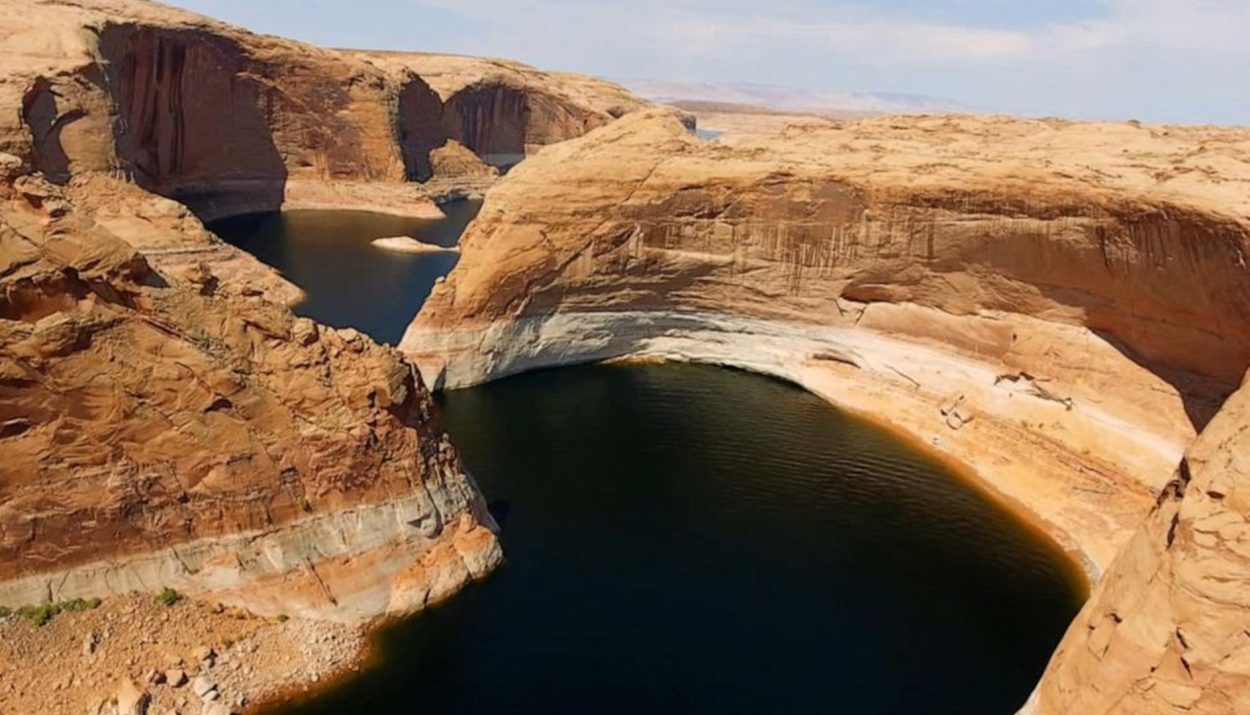
It’s been almost a year since Lake Powell reached dangerously low levels, and although the man-made reservoir has risen since, there is still much reason for concern.
Last year, it was reported that Lake Powell, the nation’s second-largest reservoir had reached its lowest levels since its first filling in the 1960s. Its companion reservoir, Lake Mead, was also reported to be almost as low. Lake Powell provides water and power to millions of people in southern California.
Discover Lake Powell: Nature’s Oasis In Utah And Arizona
Lake Powell is located on the Colorado River in Utah and Arizona, USA. It attracts about two million visitors annually and is a popular vacation spot. When filled to its maximum capacity, it can hold approximately 24,322,000 acre-feet (3.0001×10¹⁰ m3) of water.
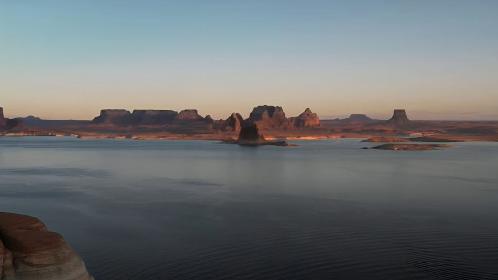
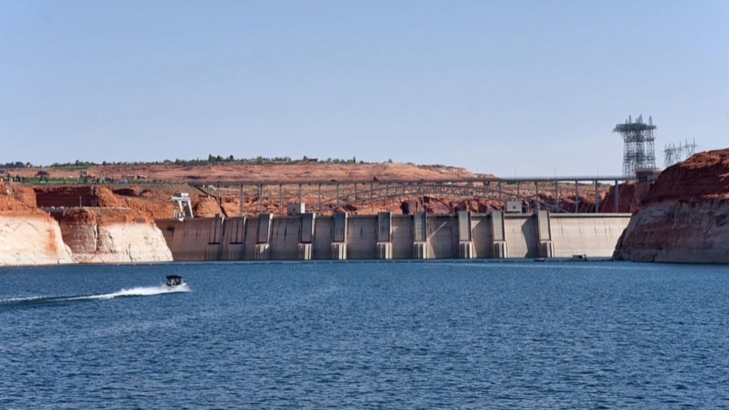
Lake Powell was created by the flooding of Glen Canyon by the Glen Canyon Dam. This also led to the establishment of the Glen Canyon National Recreation Area in 1972. The reservoir is named after John Wesley Powell, a Civil War veteran who famously explored the river in 1869 using three wooden boats.
Dire Decline: Lake Levels Plunge In Southwest Reservoirs
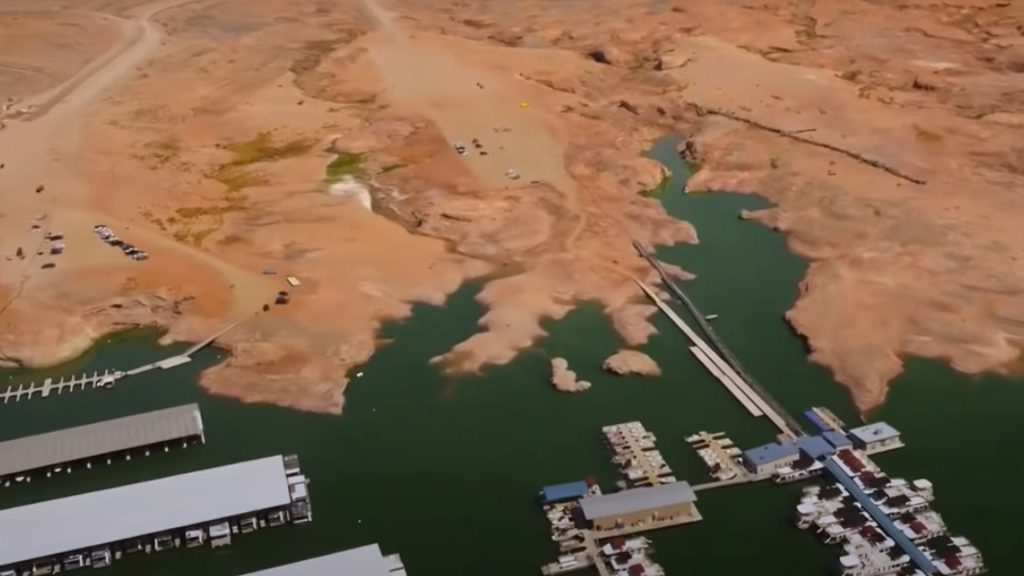
“In the year 2000, the two reservoirs were 95% full. They’re roughly 25% full now,” said Brad Udall, a water and climate scientist at Colorado State University. “It’s hard to overstate how important the Colorado River is to the entire American southwest.” All 10 of the lake’s lowest recorded measurements were taken in March and April.
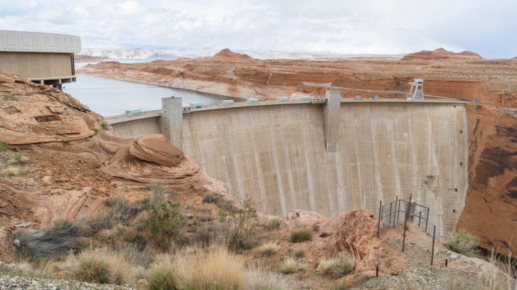
On April 12 and 13 last year, the water level fell below 3,520 feet. It reached its highest point of 3,584 feet on July 8, but it has been decreasing since then. As of Thursday, the measurement was at 3,564 feet, with over half of the boat launch ramps and other areas inaccessible.
Lake Powell Origins: Building Glen Canyon Dam
In the 1940s and early 1950s, the United States Bureau of Reclamation had plans to build several dams along the Colorado River in the rugged Colorado Plateau region spanning Colorado, Utah, and Arizona.
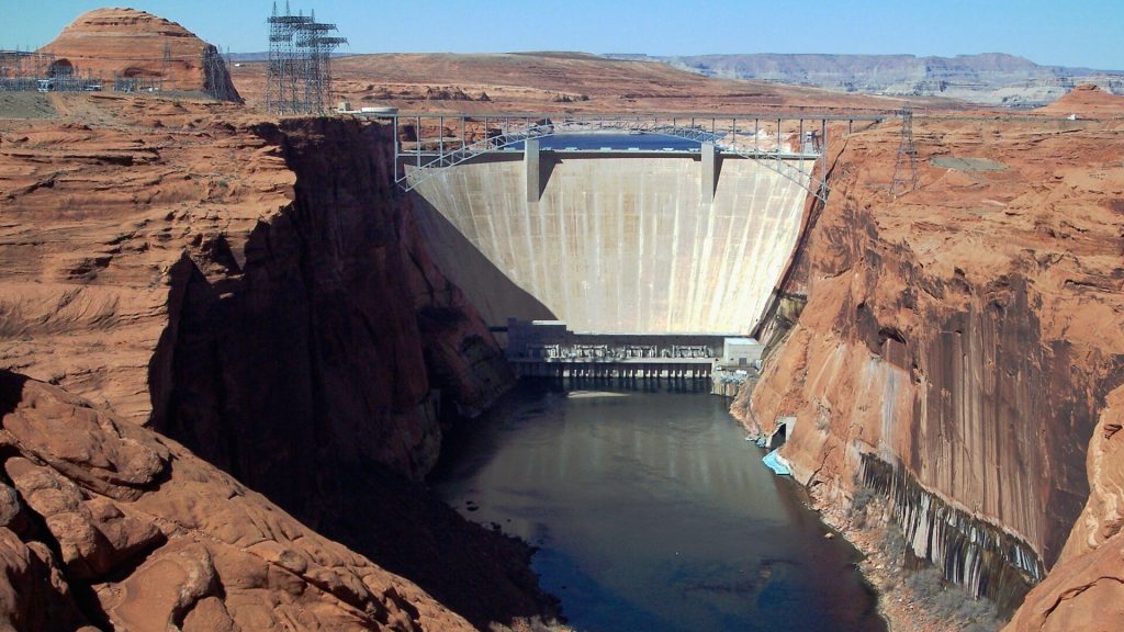
Glen Canyon Dam emerged from a controversial decision by the Bureau to choose a dam site in Echo Park, which is now part of Dinosaur National Monument in Colorado.
From Blast To Flow
Construction of Glen Canyon Dam began when President Dwight D. Eisenhower pressed a button in the Oval Office on October 1, 1956, to start a demolition blast. This blast cleared tunnels for diverting water.
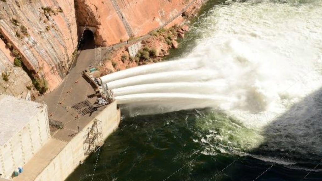
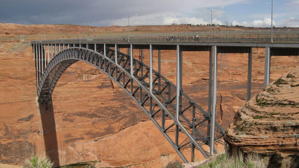
On February 11, 1959, water started flowing through the tunnels so workers could build the dam. That same year, a bridge was finished, allowing trucks to bring equipment and materials for the dam and the new town of Page, Arizona.
Glen Canyon Dam: Construction Facts And Legacy
Concrete pouring began non-stop on June 17, 1960, and finished on September 13, 1963. More than 5 million cubic yards of concrete were used to build Glen Canyon Dam. The dam stands 710 feet tall, and the water level when full is about 3,700 feet high.
Building the dam cost $155 million, and unfortunately, 18 people lost their lives during construction. From 1970 to 1980, turbines and generators were added to produce hydroelectricity. On September 22, 1966, Lady Bird Johnson officially dedicated Glen Canyon Dam.
The Birth Of Lake Powell And Its Vital Role In The Southwest
After Glen Canyon Dam was finished on September 13, 1963, the Colorado River stopped flowing through the tunnels and started to fill up the area behind the dam. This created Lake Powell. It took sixteen years for the lake to reach its highest level of 3,700 feet on June 22, 1980.
According to The Hill, Lake Powell provides water for 5.8 million homes and businesses in Arizona, Colorado, Nebraska, Nevada, New Mexico, Utah, and Wyoming.
Drought Strains Southwest Water Supply
Since 2000, Lake Powell has been getting smaller due to a big drought in the Southwest and using too much water, as reported by Newsweek last February.
Even if there’s more rain and snow than usual, it might not be enough to make a difference.
Lake Powell’s Big Problem: Dead Pool Dilemma
Newsweek reported last year that the big worry is Lake Powell, found in Utah and Arizona, might drop to a “dead pool” level of 3,370 feet. This means the dam that makes electricity might not work anymore.
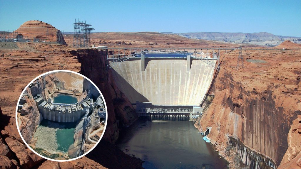
“If dead pool were reached, it would be a catastrophe,” Newsweek reported last February. “Much of life in the southwest U.S. exists as we know it due to the Hoover Dam – and dead pool would cause all its operations to cease.”
Anthony Arrigo: Dams’ Key Role In Southwest Living
Anthony F. Arrigo, who wrote a book about the dam, said: “Without the dams on the Colorado River, it’s not an exaggeration to say that the southwest would be almost impossible to live in. The reason why we can live in the southwest like we do today is because of the dams. There isn’t any other reason.”
Arrigo and Robert Glennon, a water expert from the University of Arizona, told Newsweek that if the dams didn’t exist, tribes, farms, and cities downstream would suffer.
Colorado River Crisis: Short And Long-Term Strategies For Water Management
“In the short term, Colorado River water users need to figure out how to use less water,” Audubon Colorado River Program director Jennifer Pitt told Newsweek. “There is broad agreement that water uses need to be reduced by about 30%, but there’s not yet agreement about who should use less.”
“… In the longer term, as climate change continues to warm the region, the problem will get worse, so reducing carbon emissions has to be part of the solution as well.”
Proposals And Perspectives On Addressing Lake Powell’s Decline
According to Denver’s 9News last year, on the day of the historic low, the federal Bureau of Reclamation suggested options like digging tunnels around the dam to let the river flow again or lowering the power turbines to the ground.
Gary Wockner, co-founder and executive director of the nonprofit Save the Colorado, told the television station the dam should be decommissioned. “There’s a huge opportunity here to right some historic environmental wrongs and perhaps make more logical sense about how we manage the entire river system,” he said.

